
Marco weakening, Laura expected to make landfall late Wednesday, early Thursday
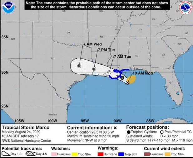
Marco is weakening quickly and is not expected to cause any weather problems in our region today or tomorrow, according the 10 a.m. update from the National Weather Service in Lake Cahrle
The tropical storm warnings have been discontinued for south central and southwest Louisiana. Most of the rain associated with Marco is well to the east of the system.
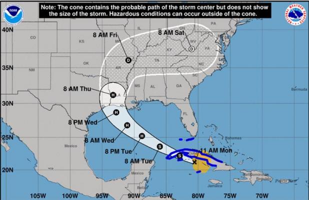
Laura is expected to make landfall between southeast Texas and south central Louisiana as a category two hurricane late Wednesday or early Thursday.
Everyone should be preparing for a category three hurricane due to the typical hurricane forecast errors, especially when it comes to wind speeds.
Laura could see some strengthening today if it stays over the water south of Cuba.
It will enter the southeastern Gulf of Mexico late tonight.
Laura will strengthen to a hurricane in the Gulf before making landfall in southeast Texas to south central Louisiana late Wednesday/early Thursday, possibly as a major hurricane (category 3).
